
Ines Walter · 26 September 2026
Historic Tree Data from County Records Powers New Climate Modeling Approaches
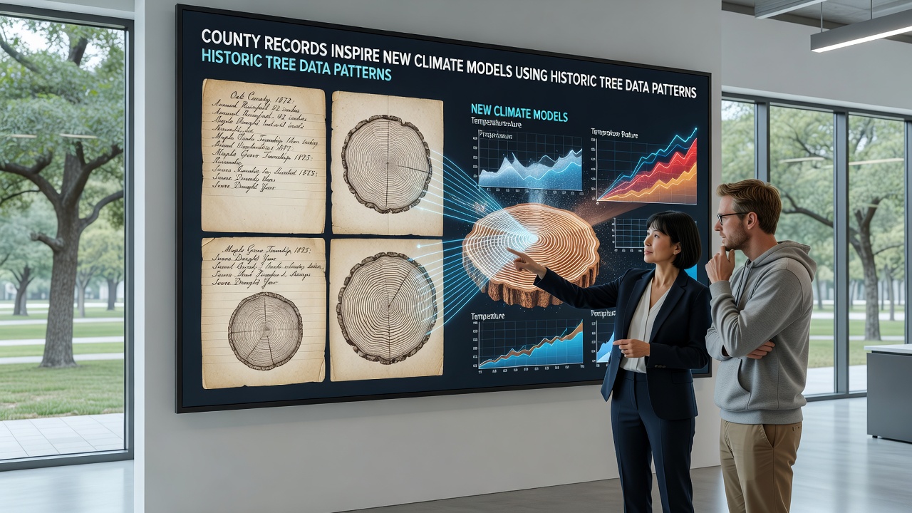
County archives across multiple regions contain detailed planting logs, growth measurements, and land management notes that date back centuries, and these documents now supply critical inputs for updated climate simulations. Researchers extract patterns from tree ring widths, densities, and species distributions recorded in those files, then cross-reference the information with modern sensor data to refine models that project temperature shifts and precipitation changes over the coming decades. The approach builds on established dendrochronology techniques while adding layers of local context that global datasets often overlook.
Archival Sources and Data Extraction Methods
County clerks in various jurisdictions maintained registers of tree plantings tied to agricultural grants, estate inventories, and public works projects, and these entries frequently include dates, species, and approximate locations that allow precise mapping. Teams digitize the handwritten entries, apply optical character recognition, and align the resulting timelines with core samples taken from surviving trees in the same areas. This process reveals growth anomalies that correspond to known drought periods or volcanic events, thereby calibrating the models against verifiable historical benchmarks.
Additional variables captured in the records include soil amendments, pruning schedules, and pest outbreaks, all of which influence ring formation. Analysts incorporate these factors into algorithms so that simulations distinguish between climate-driven changes and human interventions. Several regional studies have already demonstrated improved accuracy when such localized variables enter the equations, particularly for mid-latitude zones where county-level documentation tends to be most complete.
Integration with Contemporary Climate Frameworks
National meteorological agencies and university laboratories feed the processed county data into ensemble models that combine tree-ring chronologies with ice-core records and satellite observations. The added granularity helps reduce uncertainty ranges in projections for specific watersheds and agricultural belts. In September 2026 a collaborative release scheduled by North American and European research consortia will incorporate the latest batch of digitized county series, allowing modelers to test revised parameters against the most recent instrumental measurements.
One notable outcome appears in revised drought indices for the American Midwest and parts of central Europe, where county notes from the 1800s document tree survival rates during documented dry spells. These observations anchor statistical relationships that previously relied on fewer data points, tightening confidence intervals around future risk assessments.
Case Examples from Multiple Regions
Take the experience of analysts working with 19th-century records from counties in the Pacific Northwest. They identified clusters of Douglas fir plantings noted in land office ledgers, then matched those stands with core samples that showed suppressed growth during the 1880s. When the same growth signature was compared against broader tree-ring networks, the county data revealed a localized precipitation deficit that standard continental reconstructions had smoothed over. The finding prompted adjustments in regional downscaling routines used by several forecasting groups.
Similar work in parts of eastern Australia drew on colonial-era property surveys that listed river red gum stands along with planting and felling dates. Researchers aligned these entries with ring sequences and discovered consistent responses to El Niño-driven rainfall failures in the late 1800s. The patterns now inform parameterizations in models operated by the CSIRO Climate Science Centre, improving seasonal outlooks for the Murray-Darling basin.
Technical Challenges and Validation Steps
Transcription errors in older ledgers require careful cross-checking against multiple sources, while species misidentification in historical texts demands botanical verification. Teams therefore apply statistical filters and consult herbarium records before final inclusion. Validation proceeds through blind tests in which portions of the county dataset are withheld, then compared against independent proxy series such as those maintained by the NOAA Paleoclimatology program. Agreement between withheld records and model outputs confirms the reliability of the added parameters.
Computational demands rise when fine-scale variables enter the simulations, yet advances in high-performance computing have made routine incorporation feasible. Parallel processing allows ensembles that once required weeks to finish overnight, freeing analysts to iterate on parameter choices derived from the county material.
Conclusion
County records of historic tree patterns continue to supply measurable improvements in climate model resolution and regional specificity. As more archives undergo digitization and additional cross-regional comparisons become available, the technique is expected to expand into further areas where detailed land-use documentation survives. The resulting projections support planning efforts by providing tighter bounds on expected temperature and moisture shifts at scales relevant to local decision makers.